


When buying or selling land, one crucial question is, “what is Plat Map?” A plat map is a detailed representation of parcels of land, boundaries, and other features that can provide valuable information when buying or selling real estate.
But what exactly is a plat map? Why is it necessary for homeowners to be aware of it? In this article, we’ll take a closer look at what plat maps are, what kind of data they contain, and how you can use them to make informed decisions about your property. So, keep on reading!
What Is a Plat Map?
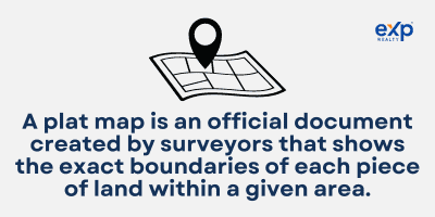
A plat map is an official document created by surveyors that shows the exact boundaries of each piece of land within a given area. A plat map shows details like streets, bodies of water, rights-of-way, buildings, and other features, such as parks or public utilities, that may affect who owns or uses the tract of land.
You can use plat maps to identify property lines for homeowners, resolve disputes between neighbors, and research zoning regulations or restrictions. Plat maps are essential for homeowners, real estate professionals, and local government entities, providing valuable information for various purposes. Knowing how to access and use a plat map can help you understand your rights as a homeowner.
Types of Plat Maps
If you’re looking to research the history behind a piece of land or a structure, it helps to have an understanding of the different types of plat maps, also called land survey maps or land maps. When buying a piece of land, you may come across five primary plat map types:
- Amending plat: This document captures all the slight modifications to an existing plat.
- Plat Of Consolidation: When a landowner acquires numerous neighboring properties and unites them into one parcel, this is known as consolidation.
- Short Plat: This process is utilized to divide a single parcel of land into up to four separate pieces.
- Plat of Subdivision: This document represents the division of a large tract of land into multiple parcels by its proprietor.
- Vacating Plat: A legal document that supersedes and revokes an existing plat.
Types of Data You Can Find on a Plat Map
Plat maps contain a wealth of information about a piece of property, including the following:
Property Lines and Boundaries
Plat maps show the exact location of a property’s boundaries, including the length of each boundary line and any corners or angles in the property’s shape. This information is a critical requirement for determining the legal boundaries of a property and resolving disputes over adjacent property lines.
Easements and Rights-of-Way
Easements are areas of a property designated for a specific use, such as a utility easement for power lines or a right-of-way for public roadways. Plat maps show the location and dimensions of these easements, which can be important for property owners who need to know where they can and cannot build structures or make improvements.
Location of Utilities and Infrastructure
Plat maps also show the location of utilities such as gas lines, access by water and sewer lines, as well as the location of buildings and other infrastructure on the property. This information can be helpful for homeowners who need to know where to dig for utility lines or for local governments planning infrastructure projects.
Waterways
Plat maps may include information on the location of waterways such as rivers, streams, and ponds. This data can be important for property owners who need to know if their property is in a flood zone or for local governments planning flood control projects.
Zoning District Boundaries
The zoning district boundaries are the legal boundaries that determine what types of uses are allowed on a property, such as residential, commercial, or industrial. The plat map may show the zoning district boundaries using different colors or shading to indicate each district.
How Do You Access a Plat Map?

Accessing a plat map can vary depending on where you live and your property type. Here are a few ways to access a plat map:
Contacting the Local Government or County Records Office
In most cases, the local government or county assessor’s office will have a copy of the plat map for your property on file. You can contact them to request a copy, and they can provide it in person or through mail or email.
Online Resources for Finding Plat Maps
Some local governments or county assessors’ offices have made them available online through their websites. It’s important to note that accessing a plat map may come with a payment, and the level of legal description available on the map may vary depending on the source.
Additionally, suppose you are looking for a plat map for a property that has been recently surveyed or subdivided. In that case, it may not be available through the local government or other sources.
Accessing a plat map may require contacting the local government or county records office or using online resources to find and access the map. Once you can access a plat map, you can use it to gain valuable information about your property.
How To Use a Plat Map?
A plat map can be valuable for homeowners, real estate professionals, and local governments. Here are some of the ways you can use a plat map:
Determining Property Boundaries and Disputes
Plat maps provide detailed information on the legal boundaries of a property, making them essential for resolving disputes over property lines or identifying encroachments.
Planning Home Improvement Projects and Additions
Plat maps can help homeowners understand the layout and features of their future property, making it easier to plan home improvement projects, actual costs and expansions.
Understanding Zoning Regulations and Building Codes
Plat maps may also include information on zoning regulations and building codes that affect the property. This can be useful for homeowners who want to understand their property’s permitted uses and restrictions.
Real Estate Transactions
Plat maps can be used by real estate agents and Title Company when conducting a title search to provide clients with accurate information on a property’s boundary locations and features.
Environmental Assessments
Plat maps can identify potential environmental hazards or sensitive areas on nearby properties, such as wetlands or floodplains, on nearby properties.
Emergency Planning
Emergency responders can use Plat maps to identify the location of utilities, structures, and access points on a property to notice the people in the event of an emergency.
Overall, a plat map provides a wealth of information about a property, making it a valuable tool for various purposes. By familiarizing yourself with the plat map for your property, you can better understand its layout, features, and legal boundaries and make more informed decisions about its use and improvement.
Key Takeaways
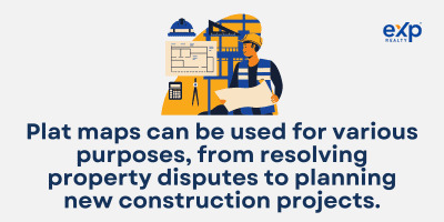
Plat maps are essential for homeowners, real estate professionals, and local governments. By providing detailed information on property boundaries, infrastructure, and natural features, plat maps can be used for various purposes, from resolving property disputes to planning new construction projects. Whether you are a homeowner, real estate professional, or local government official, plat maps are essential for understanding and managing property.
Looking for more information on plat maps or have a question about your property boundaries? Contact a local real estate agent at eXpRealty today for expert guidance and support. Our agents have access to a wealth of resources and can help you navigate the often complex world of real estate. Don’t wait – reach out today to learn more!
FAQs: What is a Plat
Here are the frequently asked questions related to the plat map.
Why are plat maps important?
Plat maps are essential because they provide detailed information on property boundaries, easements, rights-of-way, and the location of infrastructure and access to utilities. This information is essential for resolving property disputes, planning construction projects, and understanding zoning regulations and building codes. With accurate plat maps, it would be easier to assess the value of a property or determine its future development.
Plat maps are also important for emergency planning, as they can identify the location of structures, access points, and utilities in the event of a natural disaster or other emergencies. Additionally, plat maps can provide valuable information for historical research, allowing historians and genealogists to understand the growth and development of a community over time.
What is a plat, and who uses it most often?
A plat is a map or a survey that shows the boundaries and physical features of a piece of land, such as a lot, block, or tract of land. Plat maps typically include lot dimensions, street names, easements, and other geographic features.
Surveyors, engineers, and other professionals involved in land development often use Plat maps. Local governments also use them to manage land use, zoning, and infrastructure development. In addition, homeowners, real estate professionals, and prospective buyers or developers may also use plat maps to gain information about a property’s boundaries and features.
How do you map a tract of land?
Mapping a plot of land typically involves hiring a professional surveyor or engineer to survey the property. The surveyor will use specialized equipment such as GPS devices, theodolites, and total stations to accurately measure and mark the property boundaries.
They may also identify any physical entities on the property, such as structures, utilities, and natural elements like trees or bodies of water. Based on the information gathered during the survey, the original surveyor will create a plat map showing the property’s boundaries, dimensions, and features.
The plat map is typically recorded with the county clerk or city government where the property is located and becomes a legal document that you can use to resolve disputes, plan development projects, and understand zoning regulations and building codes.
What is a plat used for?
A plat provides a detailed and accurate representation of a piece of land’s physical features and boundaries. It is used by surveyors, engineers, and other professionals involved in land development and local governments to manage land map, use, and zoning.
Additionally, homeowners, real estate professionals, and prospective buyers or land developers may use plat maps to gain information about a property’s boundaries and features, such as the location of utilities and infrastructure, property line maps, and other geographic features.
What are the uses of the plat map?
Plat maps have a variety of uses. They provide information on property boundaries, easements, rights-of-way, and the location of infrastructure and utilities. This information is essential for resolving property disputes, planning construction projects, and understanding zoning regulations and building codes. You can also use plat maps for emergency planning and historical research.
What is the difference between a survey and a plat?
A survey is a physical measurement of parcels of land to determine its exact boundaries and features. It is conducted by a licensed surveyor using specialized equipment such as GPS devices and theodolites. A plat, on the other hand, is a map or diagram showing a land survey’s results. It provides a visual representation of the property dimensions, boundaries, and features.
What is an example of a plat?
An example of a plat is a map showing a residential subdivision’s layout and boundaries. The plat would include the lot numbers and dimensions, street names, and other relevant features, such as parks, public roads or open spaces.
The plat would be recorded with the local government and become a legal document that you could use to resolve disputes between property owners or to understand zoning regulations and building codes in the area. Plat maps are also commonly used for commercial and industrial properties, an acre of land, and infrastructure projects.
What is the difference between a plat and a plot?
The terms “plat” and “plot” can sometimes be confused, but they have different meanings. A plot refers to an individual parcel of land, usually with defined boundaries. At the same time, a plat is a map or diagram showing a more extensive area’s layout and boundaries, such as a subdivision of land, neighborhood, or city block.
Plat maps are typically used to record property lines and ownership, while plot maps are used to identify a specific piece of land. You may include plots in a plat, but a plat may consist of multiple plots.
How do I find my property line for free?
There are several ways to find your property line for free. One way is to check your property survey, typically provided when purchasing your home. If you still need an original survey, you can often find one at your local government public records office or online.
You can also use online resources such as Google Maps or satellite imagery to approximate your property boundaries. However, these tools may need to be more accurate, and it’s best to consult a licensed surveyor if you need precise information.
How do you read plats?
To read a plat:
- Look for the scale and orientation information. This will help you understand the size and direction of the depicted real property.
- Look for the lot dimensions and other boundaries or features, such as easements or rights-of-way.
- Check for any labels or symbols that indicate the location of infrastructure, utilities, or other physical features. If there are multiple pages, review them all to get a complete picture of the real property.
- Pay attention to the legend or key, which will explain any symbols or labels used on the plat.